
 |
Pedal through 184 miles of history
| |  Print landscape, double sided, short side flip.
|
Share link: https://my.ava.org/event-view.php?sn=130259
Click to copy link to system's cut & paste clipboard
C&O Canal Towpath Bike Event
Year Round Bike
SN: 130259 - 2026 / Y0699

From Thu, Jan 1st, 2026 to Dec 31st, 2026

Start times: Dawn to Dusk
Hosted on the Online Start Box (OSB) only

Williamsport, Maryland
WARNING: The map pin is for reference only and may not accurately indicate the start box location or the event start.

| Special programs Rails-To-Trails CC: Washington County |
Special programs that are applicable to all events or all walks
are not shown to reduce clutter.
|
Event comments
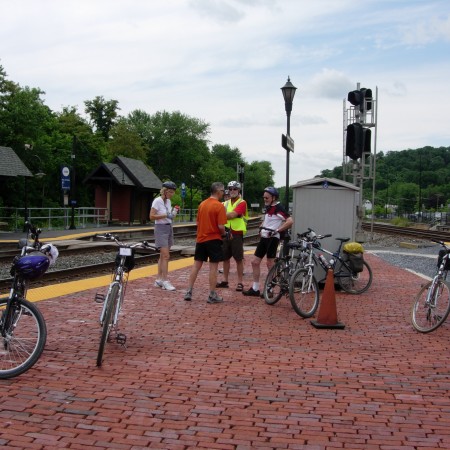
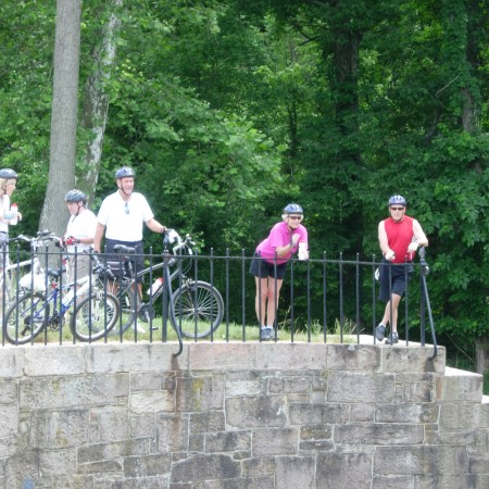
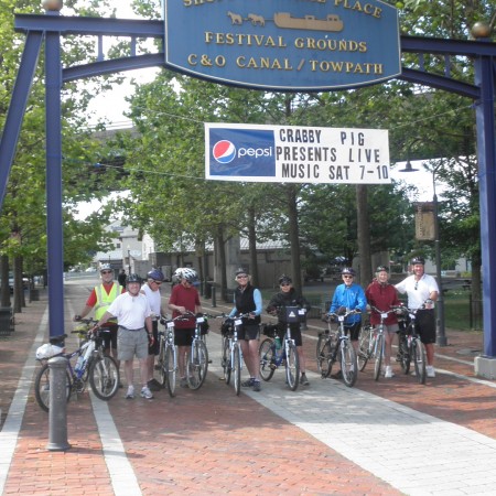
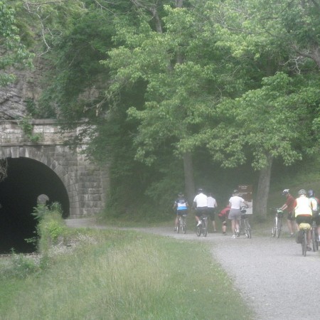
You pick your distance (10k minimum) and your start/finish points accessible from Interstate Highways I495, I270, I70 and I68. The C&O Canal National Historical Park winds its way 184.5 miles from Georgetown in Washington, DC to Cumberland in beautiful western Maryland. The trail, a well-kept gravel towpath nestled between the Potomac River and the canal, is a journey through history with 74 lift locks, restored lock houses, aqueducts, and the amazing mile-long Paw Paw tunnel. Bicyclists will enjoy spectacular scenery, beautiful river vistas, and wildlife along the trail. The surface of the towpath is for the most part an even hard packed gravel trail. The paved 22-mile Western Maryland Rail trail which parallels the canal may also be ridden as an option on this event. The towpath can be very muddy following heavy rain. There are 30 hiker / biker campsites along the trail available free on a first come basis for those interested in the longer distances. Go to www.nps.gov/choh/index.htm for more park information. For updates on trail conditions and other warnings, see https://www.nps.gov/choh/planyourvisit/conditions.htm

Rating: 1B, Distance: 10 TO 300km
|
Restrooms: Yes |
Pets: Yes |
|
Strollers: Hard |
Wheelchairs: Hard |
Event information
The C&O Canal National Historical Park winds 184.5 miles from Georgetown in Washington, DC to Cumberland in beautiful western Maryland. The trail, a mostly well-kept towpath nestled between the Potomac River and the canal, is a trip through history, with 74 lift locks, restored lock houses, aqueducts, and the amazing mile-long Paw Paw tunnel. Cyclists will enjoy spectacular scenery, beautiful river vistas, and abundant wildlife along the trail. Pick your distance from a leisurely 10K to a 300K camping adventure.
Awards: IVV CREDIT ONLY

OSB - First register for the event
The detailed location of, and driving directions to, the event starting point are included in the event directions, downloaded from the Online Start Box (OSB). To plan your travels, please use the map on this page or the maps phrase below, if provided by the club. The POC does not provide event directions nor accept alternate payment methods.
Maps phrase and directions link
Click "GO" to bring up the directions on Google maps to the event starting point.
|
Williamsport Maryland | |
The above maps phrase is only provided for planning purposes. The downloaded event directions provide detailed directions to the starting point and possible alternate start point locations. THERE IS NO PHYSICAL START BOX AT THIS LOCATION.

Maryland Volkssport Assn. (AAA-MD)
Event website: www.mdvolks.org/yres/yres.php

Click inside the box to send an email to the POC.